Geography, climate and economy
Cheat Mountain: The Basics
Where the mountain is, how high it gets, what grows on it, how much snow falls, and who lives in the county at its southern end. With a map, NOAA climate normals and county economic data.
Cheat Mountain is a single long ridge in the Allegheny Mountains of eastern West Virginia. It is about 50 miles long from north to south and more than five miles wide at its widest.1 Most of it lies in Randolph County. Its southern end, the highest part, crosses into Pocahontas County, and that is where Snowshoe Mountain Resort sits.12
The name causes confusion. "Snowshoe Mountain" is the resort, not a mountain; the resort is on Cheat Mountain.2 And the Cass Scenic Railroad, which many visitors assume climbs Cheat, actually tops out on Back Allegheny Mountain, the ridge that meets Cheat at its southern end.1
List of places on the map
- Thorny Flat (summit of Cheat Mountain, 4,848 ft): 38.3936, -79.9839 (source)
- Cheat Mountain (ridge, northern section): 38.6411, -79.9131 (source)
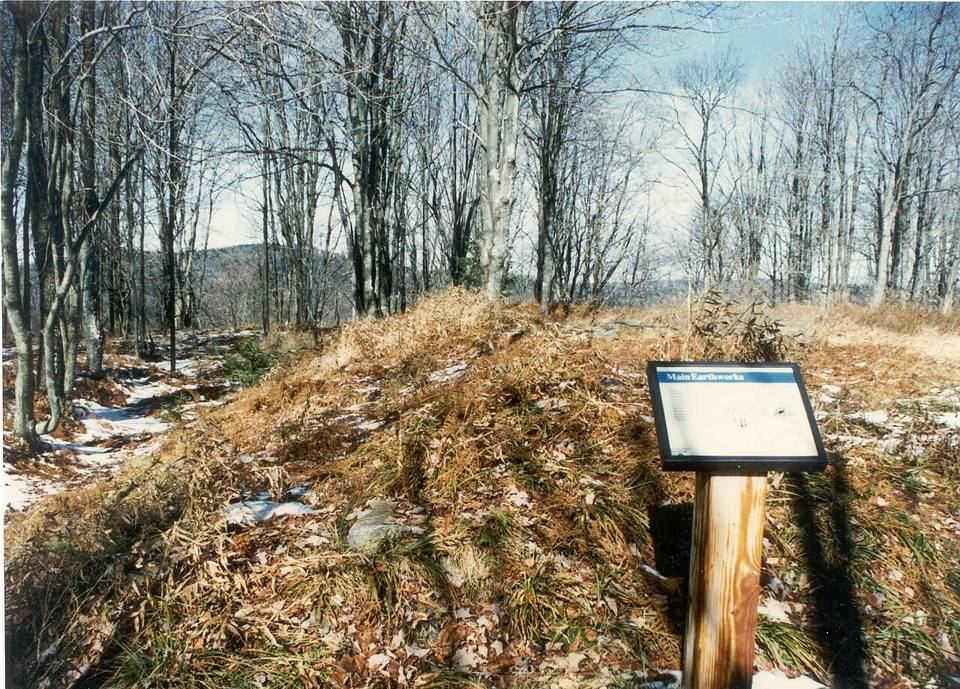
- Cheat Summit Fort / White Top: 38.6244, -79.8767 (source)
- Snowshoe village: 38.4097, -80.0142 (source)
- Bald Knob (Back Allegheny Mtn., 4,843 ft): 38.4478, -79.9311 (source)
- Cass: 38.3967, -79.9147 (source)
- Spruce (ghost town): 38.4567, -79.9558 (source)
- Droop Mountain Battlefield: 38.11, -80.2722 (source)
- Marlinton (county seat): 38.2247, -80.0947 (source)
- Green Bank Observatory: 38.4379, -79.8362 (source)
- Greenbrier River Trail at Marlinton: 38.2217, -80.0942 (source)
- Cranberry Glades: 38.2031, -80.2664 (source)
- NOAA Snowshoe weather station (4,847 ft): 38.3989, -79.9947 (source)
Where it is
The ridge runs from a northern point just west of Parsons, in Tucker County, south to a point about five and a half miles below the Randolph and Pocahontas county line, near Stony Bottom, where it runs into Back Allegheny Mountain.1 U.S. 219 follows the Tygart Valley along its western flank through Elkins, Beverly, Huttonsville and Valley Head. The eastern flank drops to the valley of Shavers Fork. Two federal highways cross it: U.S. 33 in the north and U.S. 250 in the south. U.S. 250 runs close to the line of the old Staunton and Parkersburg Turnpike, the road that brought the armies here in 1861.
Shavers Fork rises near the resort and runs north along the mountain's east side. At Parsons it joins Black Fork to form the Cheat River, which flows north into Pennsylvania and empties into the Monongahela at Point Marion.3 The resort sits in "the bowl shaped convergence of two mountains, Cheat and Back Allegheny, at the head of the Shavers Fork of the Cheat River."2
A large part of the mountain is public land in the Monongahela National Forest, including the site of Cheat Summit Fort.14 The resort and the land around Thorny Flat are private.
How high
The high point of Cheat Mountain is Thorny Flat, at 4,848 feet, the second highest summit in West Virginia after Spruce Knob.56 Snowshoe's summit is also 4,848 feet, and the NOAA weather station there sits a foot lower.78
St. Bernard Chapel, near the top of the village, stands at about 4,800 feet.9
Bald Knob, the 4,843 foot summit reached by the Cass railroad, is often lumped in with Cheat. It is the high point of Back Allegheny Mountain, a separate ridge.10 It is not the highest point of the Cheat range.
The fort at White Top stood at 4,085 feet.11 Cranberry Glades, in the southwest of the county, are at about 3,400 feet.12 The county as a whole has a mean elevation of 3,219 feet, the sixth highest county east of the Mississippi.6
Rock and soil
The geology of the ridge itself awaits a proper treatment from the maps and county reports of the West Virginia Geological and Economic Survey, and this section stays short until then. The ridge is high enough, and its soils thin and acidic enough, to support plant communities usually found much farther north.1012
Forest and wildlife
Before 1900 the high ridges carried "the largest red spruce forest south of Maine."1 On Bald Knob, oak, hickory, birch, beech and maple grew at the lower and middle elevations and red spruce on the summit dome, with rowan, hemlock and balsam fir above 4,000 feet.10
Almost all of that spruce was cut. On Bald Knob nearly all the virgin red spruce was gone by 1940 and the last spruce and hemlock harvest came in 1960.10 The logging story has its own article on this site. Spruce is returning, slowly.
The best known animal on the mountain is a three to four inch salamander. The Cheat Mountain salamander was first found on White Top in 1935 and lives nowhere outside the high country of eastern West Virginia. It has been federally listed as threatened since 1989.1314 It also has its own article.
South of the mountain, Cranberry Glades hold five small boreal bogs covering about 750 acres, with cranberries, sphagnum moss and two carnivorous plants, the purple pitcher plant and sundew.12 The Glades became a National Natural Landmark in 1974.
Climate
The mountain is cold and wet. The figures below are the official 1991 to 2020 normals for the Snowshoe weather station.8
Data table
| Month | High F | Low F | Precip. in. | Snow in. |
|---|---|---|---|---|
| Jan | 29.8 | 14.3 | 6.06 | 35.5 |
| Feb | 31.8 | 15.9 | 4.95 | 31.4 |
| Mar | 38.9 | 22.8 | 5.97 | 27.2 |
| Apr | 51.0 | 33.0 | 5.17 | 8.5 |
| May | 59.7 | 43.2 | 5.84 | 0.8 |
| Jun | 66.6 | 51.3 | 5.71 | 0 |
| Jul | 69.8 | 55.4 | 4.87 | 0 |
| Aug | 68.8 | 54.6 | 4.76 | 0 |
| Sep | 63.5 | 49.1 | 4.42 | 0 |
| Oct | 53.3 | 38.1 | 4.1 | 2.8 |
| Nov | 42.0 | 27.2 | 4.47 | 9.7 |
| Dec | 34.1 | 19.8 | 6.22 | 28.8 |
| Year | 50.8 | 35.4 | 62.54 | 144.7 |
A January day at the station averages a high of 29.8 F and a low of 14.3 F. In July the averages are 69.8 F and 55.4 F. The year averages 43.1 F. Precipitation totals 62.54 inches a year, and on average 218 days a year bring at least a hundredth of an inch.8
Records at the station since 1975 run from 87 F in July to minus 36 F in January.15 In August 1861 ice formed overnight at Lee's camp on Valley Mountain, and snow has fallen at high elevations here in every month except July.1610
How much snow?
Snowshoe averages 144.7 inches of snow a year.8 January is the snowiest month at 35.5 inches, followed by February at 31.4 and December at 28.8.
The resort advertises 180 inches, a figure that has been widely repeated, and higher totals circulate as well.27
People and the economy
Snowshoe is in Pocahontas County, one of the least populated in the state. It had 7,869 people in 2020, down from 8,719 in 2010, and an estimated 7,602 on July 1, 2025.17 With 940 square miles of land, that is 8.4 people per square mile.
The population is older than the nation's: 29.1 percent of residents are 65 or over and 17.6 percent are under 18. Median household income was $42,119 (2020 to 2024 American Community Survey, in 2024 dollars), and 17.4 percent of residents live in poverty.17 The median value of an owner-occupied home is $152,400.
The business counts show what drives the county. Accommodation and food services sales were $107.3 million in 2022, larger than all retail sales ($85.0 million).17 That is the resort economy showing up in federal statistics. The county had 231 employer establishments in 2023 with 3,174 employees and a payroll of $94.0 million.
Forestry and agriculture remain part of the economy. A current breakdown by industry, from Bureau of Labor Statistics county data, is still to come.
The National Radio Quiet Zone, which limits radio transmitters around the Green Bank Observatory, covers the county. It shapes what technology is available here. Of the county's households, 74.6 percent subscribe to broadband.1718
Getting there
The resort sits above the Slatyfork area, which was not distinguished from Snowshoe before the resort, on the U.S. 219 corridor between Marlinton to the south and Elkins to the north.151 Cheat Summit Fort is off U.S. 250 near Cheat Bridge. Cass is the northern end of the Greenbrier River Trail and sits east of the resort across Back Allegheny Mountain.19 Directions are best taken from the operators: West Virginia State Parks for Cass and the trail, the Forest Service for the fort and the Glades.204
Sources
- Wikipedia, "Cheat Mountain" (CC BY-SA)
- Wikipedia, "Snowshoe Mountain" (CC BY-SA)
- Wikipedia, "Cheat River" (CC BY-SA)
- USDA Forest Service, Monongahela National Forest
- Wikipedia, "Thorny Flat" (CC BY-SA)
- Wikipedia, "Pocahontas County, West Virginia" (CC BY-SA)
- e-WV: The West Virginia Encyclopedia, "Snowshoe Mountain Resort"
- NOAA NCEI, 1991 to 2020 Monthly Normals, station SNOWSHOE, WV US (USC00468308)
- St. John Neumann Parish (Pocahontas Catholic), "St. Bernard Chapel"
- Wikipedia, "Bald Knob (West Virginia)" (CC BY-SA)
- Wikipedia, "White Top" (Cheat Summit Fort) (CC BY-SA)
- Wikipedia, "Cranberry Glades" (CC BY-SA)
- Wikipedia, "Cheat Mountain salamander" (CC BY-SA)
- U.S. Fish and Wildlife Service, Cheat Mountain salamander species profile
- Wikipedia, "Snowshoe, West Virginia" (CC BY-SA)
- Douglas Southall Freeman, R. E. Lee: A Biography, vol. 1 (Scribner, 1934), ch. 33, "The Cheat Mountain Campaign," with Lee's letters to Gov. John Letcher (Sept. 17, 1861) and Louisa Washington. Public domain text, LacusCurtius
- U.S. Census Bureau, QuickFacts: Pocahontas County, West Virginia
- Wikipedia, "National Radio Quiet Zone" (CC BY-SA)
- Wikipedia, "Greenbrier River Trail" (CC BY-SA)
- West Virginia State Parks, Cass Scenic Railroad State Park
Published 2026-10-29. Corrections: see About.